199,00 €
+ 5,99 € Livraison

Spatial Statistics

Vendu par:

199,00 €

En stock
+ 5,99 € Livraison

Retours sous 14 jours

Protection de l'acheteur

Ou choisissez un lot

Modes de paiement:

  • Marque: Unbranded

Détails du produit

Détails du produit

Spatial Statistics

Geospatial information modeling and mapping has become an important tool for the investigation and management of natural resources at the landscape scale. Spatial Statistics: GeoSpatial Information Modeling and Thematic Mapping reviews the types and applications of geospatial information data such as remote sensing geographic information systems (GIS) and GPS as well as their integration into landscape-scale geospatial statistical models and maps. The book explores how to extract information from remotely sensed imagery GIS and GPS and how to combine this with field dataâvegetation soil and environmentalâto produce a spatial model that can be reconstructed and displayed using GIS software. Readers learn the requirements and limitations of each geospatial modeling and mapping tool. Case studies with real-life examples illustrate important applications of the models. Topics covered in this book include: An overview of the geospatial information sciences and technology and spatial statistics Sampling methods and applications including probability sampling and nonrandom sampling and issues to consider in sampling and plot design Fine and coarse scale variability Spatial sampling schemes and spatial pattern Linear and spatial correlation statistics including Moranâs I Gearyâs C cross-correlation statistics and inverse distance weighting Geospatial statistics analysis using stepwise regression ordinary least squares (OLS) variogram kriging spatial auto-regression binary classification trees cokriging and geospatial models for presence and absence data How to use R statistical software to work on statistical analyses and case studies and to develop a geospatial statistical model The book includes practical examples and laboratory exercises using ArcInfo ArcView ArcGIS and other popular software for geospatial modeling. It is accessible to readers from various fields without requiring advanced knowledge of geospatial information sciences or quantitative methods. . Language: English
  • Marque: Unbranded
  • Catégorie: Éducation
  • Date de publication: 2011/05/09
  • Editeur / Label: CRC Press
  • Format: Hardback
  • Langue: English
  • Artiste: Mohammed A. Kalkhan
  • Identifiant Fruugo: 338116810-741780175
  • ISBN: 9781420069761
Engagement

Garantie du vendeur

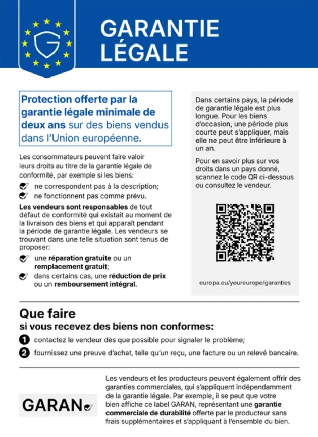
Garantie légale de 2 ans incluse

Vos droits de consommateur dans l'UE incluent une garantie légale gratuite d'une durée minimale de 2 ans

Télécharger la garantie légale de conformité
Livraison

Livraison

Expédition dans un délai de 5 jours

  • STANDARD: 7,99 € - Livraison entre mar. 08 décembre 2026–ven. 11 décembre 2026

Expédié depuis le Royaume-Uni.

Retours

Retours et annulations

Retours

Nous mettons tout en œuvre pour que les produits que vous commandez vous soient livrés dans leur intégralité et conformément à votre commande. Néanmoins, si vous recevez une commande incomplète, des articles différents de ceux commandés ou si, pour toute autre raison, la commande ne vous satisfait pas, vous pouvez retourner la commande ou tout produit inclus dans celle-ci et obtenir le remboursement intégral des articles retournés.

Consulter la politique de retour complète

Annulations

Vous disposez d'un droit de rétractation de 14 jours à compter de la réception de votre commande, sans avoir à justifier de motif. Pour exercer facilement ce droit, vous pouvez utiliser le lien « Annuler ma commande » situé en bas de chaque page ou dans votre compte Fruugo, rubrique « Commandes ». Une fois votre droit de rétractation exercé, nous vous enverrons un accusé de réception par e-mail. Si votre commande a déjà été expédiée par le vendeur, nous vous fournirons les instructions de retour nécessaires pour un remboursement rapide.

Consulter l'intégralité de la politique d'annulation